A river runs through it, travels down the valley like a liquid train hauling steelhead and silt, hauling snow melt and driftwood, hauling fir needles, spilled huckleberries, the furtive shadows of ghost dancers, the lost feathers of bald eagle, Raven, woodpecker, and loon….
A river runs through it, refusing to rest until it can taste in its mouth that sea salt for which all rivers hunger as much or more than they thirst for rain….
A river runs through it like a fugitive freight train transporting the dreams of those who work to preserve and protect this increasingly threatened drizzle land, those who recognize that maintaining a respect--- nay a reverence---for wildness, for the Skagit’s raw peaks, dark arbors, and primordial bogs, is an essential component of what it means to be truly human, truly alive.
–Tom Robbins, excerpted from his forward to “Natural Skagit”
It was late September, with the sun shining brightly but lower now, and the tree colors starting to turn. The Skagit ran milky blue through the woodlands of the lower valley.
Skagit Fisheries Enhancement Group and Skagit Land Trust were co-hosting a day at Cumberland Creek, each non-profit staffing display tables at the trailhead to encourage folks to explore these protected wetlands and maybe see some salmon swimming homeward.
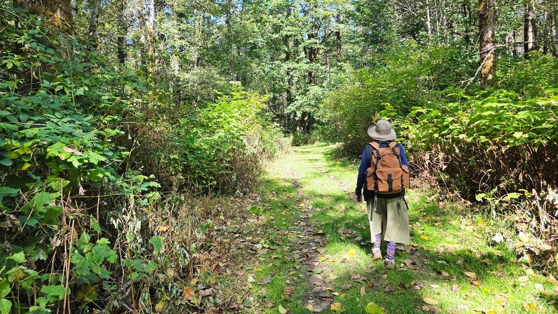
Kath, Murphy, and I went out there after watching a grandson play soccer in Mount Vernon. We greeted and chatted with the hosts, Sarah Gardam for Skagit Land Trust, and Devon Bedard for Skagit Fisheries; then we began walking the trail toward the river. Land Trust educator Stacy Dahl was leading a group of people along the Oxbow Trail, and we joined them for a while. She showed us bear-scratched spruce trees creating an enchanting hideaway. “Are there bears here right now?” we all asked ourselves. Then she led us to a viewpoint of the Oxbow that we would have missed. Invasive bullfrogs splashed in the remaining waters of the pond. Elk wallows could be seen across the way. Dragonflies basked on grass blades. Sunshine warmed the forests and meadows. Bone-bright snags lined the northern side, sharp against the boldly blue skies. At this high noon, a raven called from above, a flicker cackled, and a downy pecked away.
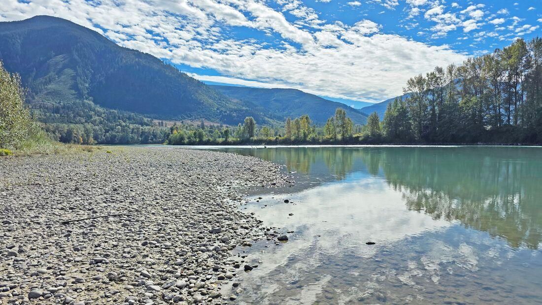
We wandered ahead of the group to the trail leading west, looking to find the Skagit River. Cottonwood trees reached over ten stories above us and carpeted the trail with golden-brown leaves. It was a noisy carpet, scaring off any chance of encountering a bear today. But soon the overstory began to thin, and then there it is, the wide Skagit flowing majestically by. We paused on the beach, soaking up the sun and the quiet, a large distant river riffle the only sound.
We retraced our steps, then took a trail to the north shoreline. The woods became darker, filled with monster maples and ancient cedars. Stacy’s group was just leaving as we neared the river.
The north riverside beach was even wider, a hundred yards of dried mud on river stones leading us to the water’s edge. Fresh elk droppings and footprints littered the beach. The river flowed, and flowed, and flowed, powerfully, silently. Sunlight filtered through the cottonwoods and turned maple leaves fluorescent green. A breeze stirred the branches a hundred feet above us, then withdrew again.
We walked back toward the beginning. We missed seeing salmon, but we know they were just out of sight. We thanked our hosts for being here and for the work they do to restore and preserve these pockets of nature, these islands of hope.
Did we find anything extraordinary, dramatic, or magnificent? Yes, every tree, scat, shrub, bug, mud, mushroom, leaf, and fallen log. Every evidence of life working together, breathing, sharing, living alongside the never-ending river of life, flowing eternally through our land. Every evidence of every person who has worked on protecting and restoring riverine habitats, such as Cumberland Creek.
Natural Skagit.
Directions
Directions: Take the South Shore Road from Highway 9 south of Sedro-Woolley about 12 miles or so, just past Day Creek a couple of miles, to the Cumberland Creek Conservation Area on your left.
By Bus or Bike: the nearest bus stop is along Highway 9. By bike, the South Shore Road is narrow, high-speed but low volume, winding, but relatively gentle uphill to Cumberland Creek.
Mobility: The trail is relatively flat and wide, though they can be muddy at times, leading to the west shore of the Skagit; the other trails are also flat but narrow and with varying tread. In September, the trails were in great condition. Have a picture of the map on your phone, or print out a copy before you go.