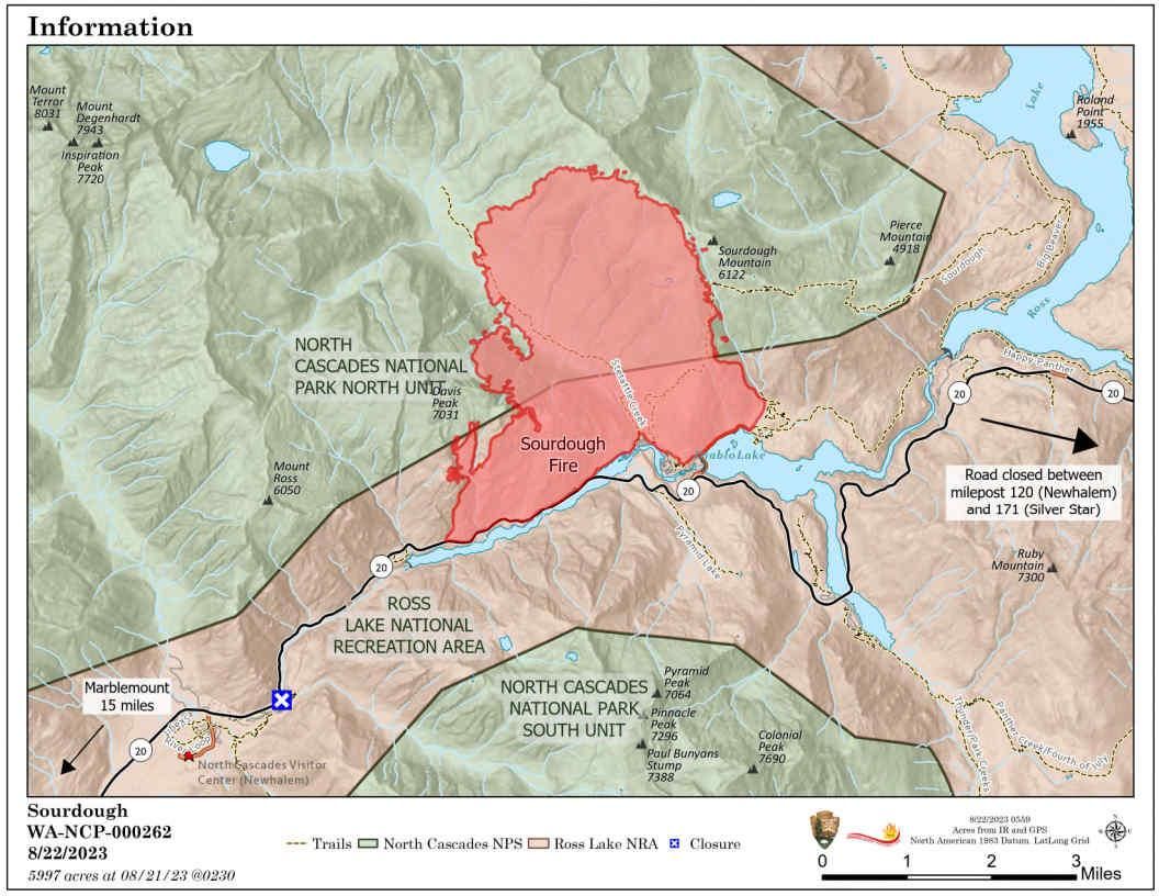
Map as of Aug 22, 2023. Closures were re-opened on Aug. 23, 2023
North Cascades Highway was re-opened on Wednesday morning to through travel only. No stopping or camping are allowed.
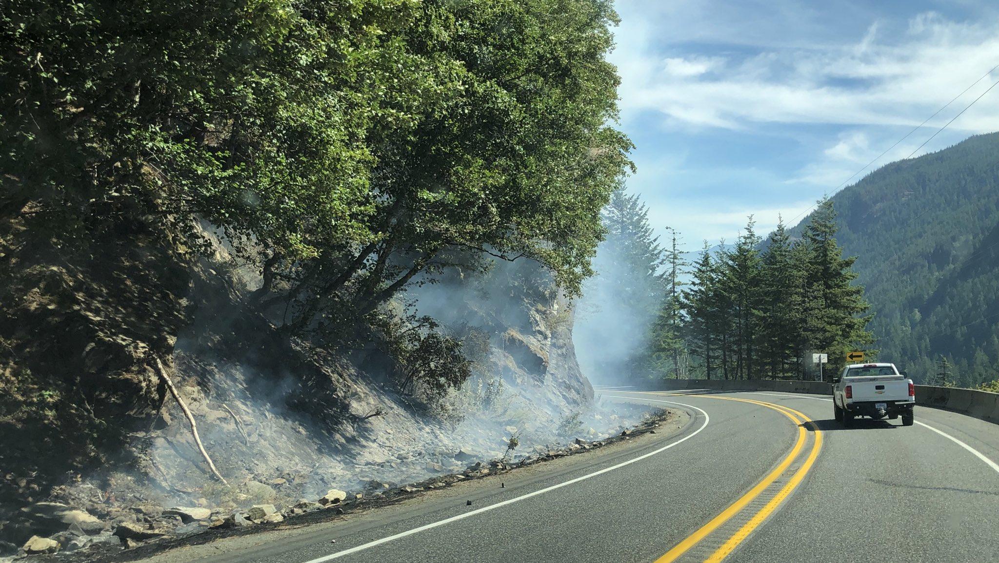
The road is open for through-travel and drivers should refrain from stopping along the highway - as crews remain actively fighting the Sourdough and Blue Lake fires.
A pilot car will direct traffic between Rainy Pass (MP 158) and Blue Lake Trailhead parking lot (MP 162) from 9:30 a.m. and 8:30 p.m. for the next few days. The road will remain open overnight while pilot car operations are not in place.
Check the National Park Service and U.S. Forest Service websites for details about trailhead, camping and recreation closures. This remains an active fire area and the road is subject to close again with little notice based on fire behavior or firefighting mitigation strategies. People are encouraged to plan ahead for unexpected closures and travel delays.
The North Cascades Visitor Center in Newhalem is open daily. Camping, trailheads, overlooks, pullouts and other recreation east of Newhalem, remain closed by the National Park Service due to the wildfires. Additional details about trail, area and camp closures are available on the North Cascades National Park Service Complex website and the Okanogan-Wenatchee National Forest website. People looking for information about the Pacific Crest Trail should visit the Pacific Crest Trail Association website
Smoke from fires throughout the region is significantly affecting many communities. Information about current conditions and a smoke forecast is located at: https://wasmoke.blogspot.com.
The Sourdough Fire started with a lightning strike on July 29 near Diablo in the Ross Lake National Recreation Area, 7 miles northeast of Newhalem. The size of the fire remains at approximately 5,997 acres with 16% containment. The current suppression strategy involves obtaining full containment primarily along the southern portion of the fire along SR 20 and other infrastructure such as buildings and utility corridors.
The remote areas of the fire to the north, where most of the fire continues to burn, the strategy is to keep the fire confined on the west and eastern flanks by natural features and past fire scars and to take action if the fire threatens values at risk.