I was in Coupeville and felt ready for a walk so I went to the Admiralty Inlet Preserve. There I met a tree swallow perched on one of the many bird boxes along the rail fence. It posed facing this way and that wearing its regal blue cape. A sign nearby said the boxes were for bluebirds. The tree swallow was mostly blue, so it moved right in.
Up ahead, what’s that on the trail? A furry rock? It sat so still. I zoomed in from a distance, trying not to disturb, but expecting it to dart into the thicket at any moment. It stayed, stock still, not batting an eye, twitching a nose, or flicking an ear. As I approached very slowly, it eyed me closely as I passed by on the trail just a foot away. Being still is being invisible. Being invisible is being alive… and being alive is extremely adorable.
A split rail fence protects the wildflower meadow. It’s knee deep in native grasses and prairie flowers, scarlet paintbrush with its fiery blossoms, blue camas lilies, and the rare golden paintbrush among others. Sparrows sang from across the meadow and chickadees hung upside down on Douglas fir cones overhead. On I went into the green tunnel of lush wild rose hedges, adorned by the gawdy broach of a cow parsnip.
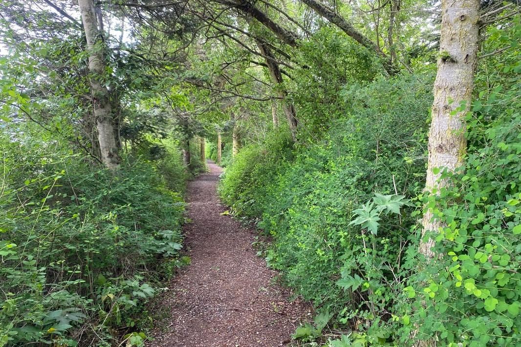
Emerging from the hedgerow I glimpsed two cyclists pedaling up the road which reminded me of the Land Trust's Pie Ride fundraiser coming up in July. I turned into the woods. The trees were taller, the trail narrower and the green was greener. Lush fringe cup framed the trail with its dainty flowers. A Pacific Wren sang sweetly from the brush. A nuthatch sounded among the trees. Careful, there’s a snail on the trail!
A trail junction at the far corner of the preserve has a sign and a map. In one direction is Camp Casey, recently acquired by Snohomish County YMCA. With their children’s programs in full swing, they’d rather not have uninvited guests. So, I turned right and slid through the fat-mans-squeeze, and along the bluff.
The fir trees there are beefier at the bottom and often broken at the top. They stand in defiance of the southwest winds that batter these bluffs all winter. Their branches twist snake-like through the canopy. Other trees fill in the understory, willows, wild cherry, alder, even a Pacific yew. I stopped under a tree that’s leaning over the trail listening to the chorus of songbirds all around me. Goldfinches are back from their winter in the south. They join our hardy chestnut-backed chickadees, golden-crowned kinglets, brown creeper, pine siskin and towhee. An orange crowned warbler sang from the branches overhead, just passing through. These woods are full of feathered friends. As I make my way I hear an eagle call, then a raven. At an overlook, I hear gulls cry from the water below. Ships pass, the ferry crosses to Port Townsend and the Olympic Mountains sit shrouded in clouds.
The artistic interpretive signs along the way have images of many of the birds and flowers on the route. I passed the enormous grandmother tree, arms outstretched, surrounded by saplings. Nearby is a bench dedicated to Linda Bartlett, a farmer and friend. Both the farmer and the tree nurture those around them with health and well-being.
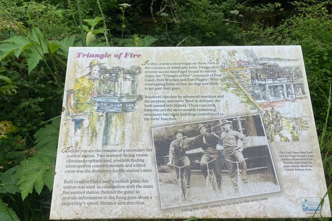
I approached an Interpretive sign and read about the remnants of Fort Casey that are almost grown over here. Admiralty Inlet, named in 1792 by British explorer, George Vancouver, was noted as a gateway to this inland sea. The military was strategic building forts on both sides of the water in the 1890s. A spotting station occupied this site. It’s hard to imagine now, walking this trail on a pleasant spring day, that this was part of a large fort at one time.
Rounding the end of the meadow with swallows circling and sparrows singing, I completed my walk with an eye to come back again soon. Spring flowers and migrating birds bring ever changing colors and songs as the season warms.
Maribeth
The Whidbey Camano Land Trust is protecting and restoring this remnant of native prairie and old growth forest. They're making vital connections with other parks and trails all over Central Whidbey. For more information about the preserve or the Pie Ride July fundraiser, click here.
Directions
Directions: From the stoplight in Coupeville on Hwy 20, turn onto South Main Street which becomes Engle Road. In 2.5 miles look for the gravel parking area on the left. The trailhead is across the street. Be careful crossing the road.
By Bus and Bike: From Coupeville take Engle Road which is mostly level. The speed limit is 35mph. Or take fare-free Island Transit Route 6 bus from Oak Harbor or Coupeville and ask them to let you off by the gravel parking area at the top of the hill. On weekends, if you call at least 2 hours ahead, you can ask for an On-Demand ride from Coupeville to the trailhead. Call (360) 678-7771. Get the current bus schedule here. (Schedules will change in June.) Two bikes fit on the bus bike rack. Please wear something bright while riding, walking or waiting for the bus by the road.
Trail Conditions: This trail is narrow in places and mostly level except for some stairs near the old fort spotting station. The surface is dirt or mowed grass with a few boardwalks or bridges in wet spots.
Republished with permission. Read the original article.