In December of 1968, our view of our home changed forever. Three astronauts on Apollo 8 watched the earth rise above the horizon of the moon. One of those astronauts, Bill Anders, took a photo. This was the first image earthlings ever had of our planet hanging out in the vastness of space.
Back on Earth, Bill said “Borders and division are merely a matter of perspective. We are bound to a planet we all must share. We are all, together, stewards of this fragile treasure.”
Bill lived in Anacortes when he retired, and recently passed away, at the age of 90.

The original image and orientation as taken by astronaut Bill Anders, 1968
In the 1850s, new immigrants to the future state of Washington consigned the original human inhabitants, the numerous tribes living along the shorelines of the Salish Sea, to small reservations, tiny remnants of their native homelands.
- The Treaty of Point Elliott: https://swinomish-nsn.gov/media/58803/treaty-of-point-elliott-v1_0.pdf
But not satisfied with that, wanting more, the federal government passed the Dawes Act in 1887 to change reservation lands to private property that could be bought and sold. A tribal family laid claim to a part of the Swinomish Reservation now called Kiket Island. But during the Depression, they fell on hard times. The descendants of that family sold the island to a non-tribal member. The island became the property of non-tribal owners for decades until the most recent owner wanted to sell it to State Parks.
Nearly fifteen years ago, I was part of a State Park group seeking to get past the logjam of negotiations to purchase Kiket Island. State Parks had secured grant funding to turn it into a state park. The beaches of Kiket would remain in Swinomish tribal ownership as part of the original reservation from 170 years ago. But the only way onto the island was across the tribal beaches, and the Swinomish did not want to grant permanent access to State Parks, just a temporary lease. Parks did not want to spend millions of dollars for land they might lose access to in the near future.
Finally, some wise person suggested a simple solution: what if Parks and the Tribe shared the island? The Tribe would retain ownership of the tidelands, but the uplands would be welcoming to all, co-owned and co-managed by the Tribe and Parks.
Share? What a concept!
The island just celebrated ten years of being open to all people, whether tribal, of European descent, or any other kind of human.
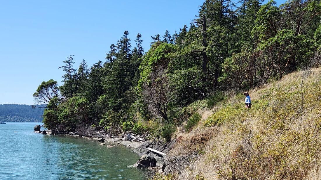
With Murphy at doggy daycare, Kath and I parked in the small parking area and walked down the access road, across the tombolo, and onto the island. We wandered along the trails leading to the meadows and beaches. A mom and her boy made a sandcastle. A young couple jogged over the crest of the island and back. An older couple aimed cameras at all the beauty they found. Eagles and osprey flew over the surrounding waters. Our own spirits soared with the freedom to hike, explore, scramble across driftwood and rocky shorelines, observe oystercatchers taking a rest, smell the salty air and warm green woodlands, sit on the beach, and just revel in this place set apart from the mainland and its world of worries.
Here we could be back on an island in the Salish Sea as it has been for centuries.
We eventually hiked back up the island, back across the tombolo, back to our car, and back to our modern lifestyle.
Kiket Island is a simple example of sharing, a concept we learned in kindergarten, if not earlier. It benefits us all. And we lose if we don’t. Together we share this planet as sisters and brothers on this island in space.
Sharing works. There is no other option for this planet. Thank you for showing us our home from a higher perspective, Mr. Anders. And godspeed as you soar to new heights.
Directions
Directions: From Sharpe's Corner east of Anacortes on Highway 20, go east two miles to Reservation Road. Turn right, and go 1.5 miles south to Snee-Oosh Road. Yes, that's its name! Take that 1.3 miles to the parking area.
By Bike: Reservation and Snee-Oosh roads are narrow and hilly but with minimal traffic.
Mobility: The main trail is wide and graveled, but the beach between the road and the island is sandy, uneven, and covered with scattered logs. And make sure it's not covered with water!
Republished with permission. Read the original article.